Tribute to the Isle of Man
Note: If you haven't already done so, click here to open a scrollable map of the Isle of Man in a separate window for handy reference.
Douglas (page 1)
Douglas is the capital of the Isle of Man, being the seat of the Manx Government and by far the largest town on the Island. The town was built at the mouth of the river Glas, at the southern end of the east-facing Douglas Bay. This sheltered part of the bay provided an ideal harbour and quayside, around which the town of Douglas grew. In 1727, the population of Douglas was 810, but by the 1850s it had risen to 9,653. The population is now over 22,000.
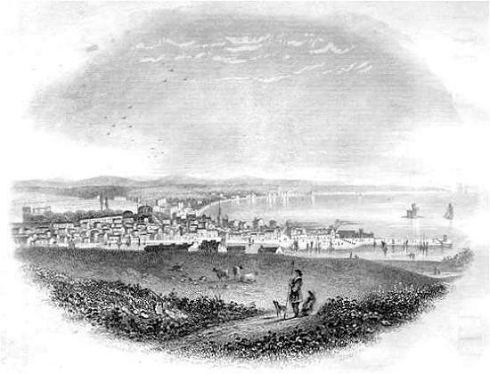
Kerruish's Illustrated Guide (4th edition) 1857 |
| Above: Douglas Bay and the town of Douglas, viewed from the south |
The 19th century engraving (above) was published in Kerruish's New Illustrated Guide to the Isle of Man - new in the 1850s. The harbour pier is to the right, and the Tower of Refuge on Conister Rock is in the middle of the bay.
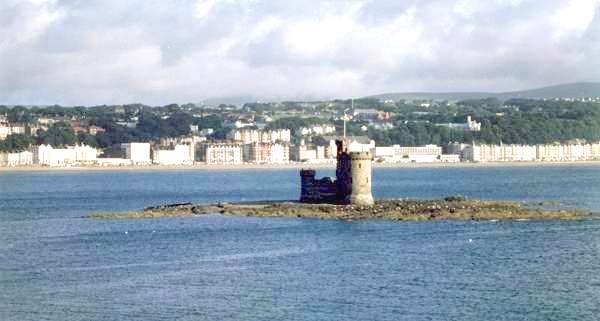
Photography by John Ball, 1985 |
| Above: Tower of Refuge on Conister Rock, with the line of sea-front hotels beyond. |
Conister Rock was a hazard to shipping because it is covered at high tide. It was the scene of many disasterous shipwrecks until 1833, when Sir William Hillary funded the erection of the Tower of Refuge.
Kerruish (1857) wrote: It forms an admirable beacon at high water, when the rock would otherwise be invisible to craft entering the harbour, and it offers a secure retreat to the struggling mariner who may chance to be cast away upon it, being furnished with chambers and a powerful alarm bell to attract assistance.
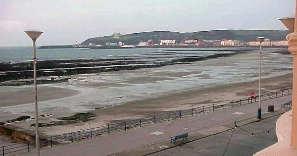
Photography by John Ball, 2001 |
| Above: Douglas Head and the Sea Terminal, from Queen's Promenade. |
The photograph above was taken at low tide, soon after dawn. The view looks south-eastwards across Douglas Bay towards the headland known as Douglas Head. The promenade and sandy beach are deserted. Just visible is the harbour pier where sea-ferry passengers and vehicles arriving from the British mainland and Ireland disembark.
The photograph below shows the lighthouse on Douglas Head, and one of the Isle of Man Steam Packet Company ferries, taking holidaymakers back to the port of Liverpool at the end of their stay on the Island.
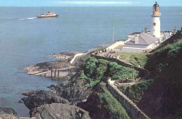
Old postcard, circa 1960s |
Above: Douglas Head Lighthouse.
This picture was taken on a fine day, but when the mist comes down, Douglas Bay echoes to the haunting sound of the lighthouse fog-horn blasting its warning out to sea. |
In the years after the Second World War, the Isle of Man, particularly Douglas, became an extremely popular summer holiday destination for the industrial workers of the north-west and midlands of England (see below).
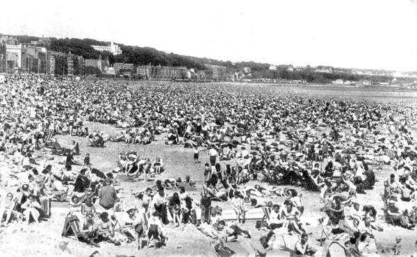
Isle of Man Official Guide Book, 1952 |
| Above: Douglas sands packed with holidaymakers in the early 1950s. |
By the 1960s, increasing affluence was bringing sunny Mediterranean resorts within the budget of Britons, and holidaymakers were enticed away from traditional British sea-side holidays. The crowds on the Douglas shore dwindled (see below).
Below: A hot day at Douglas in 1986 - a very different picture from 35 years earlier.
The headland in the distance is Onchan Head. |
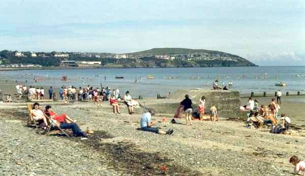
Photography by John Ball, 1986 |
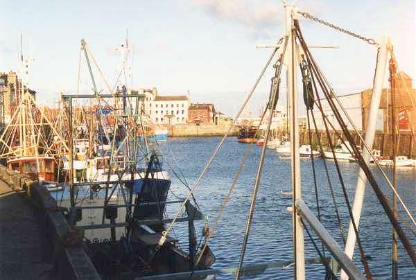
The heart of Old Douglas was its maritime quarter, clustered around the quayside. The North Quay is still busy, but with leisure craft as well as traditional fishing vessels. The photographs (below) show the appearance of the quayside in recent times.
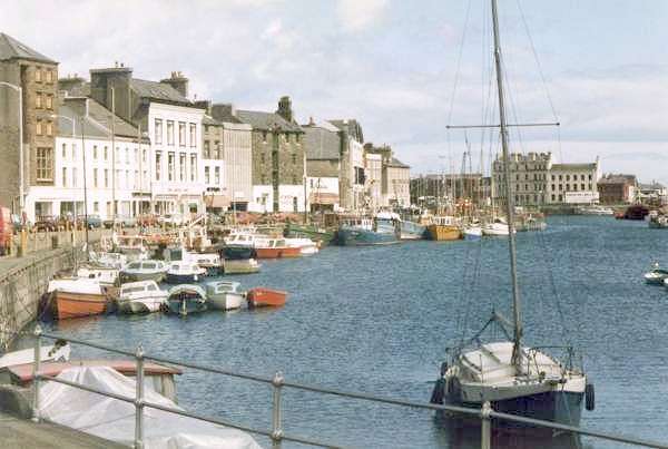
Photography by John Ball, 1985 |
| Above and below: North Quay, Douglas, looking seawards. |
Photography by John Ball, 1988 |
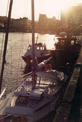
Photography by John Ball, 1988 |
|
Left: North Quay, looking west towards the setting sun.
Click here to enjoy more pictures of Douglas.
|
|